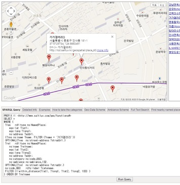
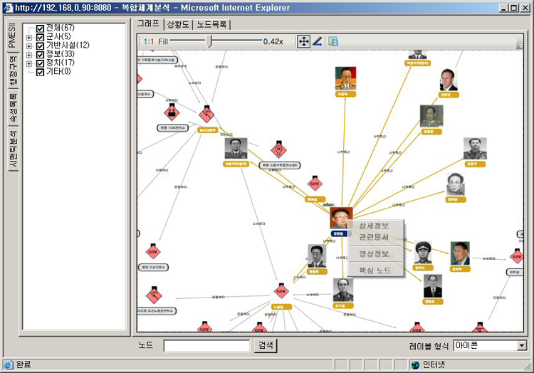
Statistics indicate that 80% of useful big data is geospatial big data related to a location, making location-based big data analysis an important one. Saltlux provides big data convergence analysis solutions which interwork GIS and semantic geospatial modeling and support in-depth analyses such as early anomaly detection, real-time marketing analysis, reputation, and local issue analysis through connections with social big data.
- Customer Problems
Implement sustainable operating systems, technology, and systems for converging and analyzing various types of big data based on region and space.
- Introduction Effects
Transportation optimization, environment monitoring and improvement, local citizens’ voice analysis, administrative services improvement, disaster response, early risk detection, local marketing optimization, national security system strengthening, and more.

- Main Functions
Semantic geography, space modeling, geographical ontology configuration, geospatial reasoning, Geo-SPARQL support, spatial query and reasoning, local-based social big data analysis, local issues, risk detection, etc.

- Built-in Products
STORM, RAINBOW, and BigO Interworking
- Major Customers
Ministry of National Defense, National Geographic Information Institute, EU Citi-sense, EU LarKC, and more.
Overview
Use semantic geospatial information in cases to provide new geographic information by reasoning and connecting various classes of data related to geographies, such as geographic features, geographic geometric features, and humanistic geographic features with location coordinates.
Geospatial Information
Geospatial information is information related to statistics, demography, sociology, genetic epidemiology, biology, geomorphology, and others based on geographic information with location coordinates. Location coordinate is WGS84 coordinate information collected by mobile terminal equipment’s sensor information. WGS84 is expressed by latitude and longitude on the earth’s surface from the center of the globe.
Semantic Technology
Semantic technology is a technology that allows people and machines to understand, share, and manipulate data. To do this, data modeling should be added, transformed, and mutually connected between data in the data set that is shared among programs.
Data modeling systematizes data concepts and defines relationships between concepts and substances corresponding to them. This is shown in the form of RDF-based ontologies through web resources. Semantic storage systems save ontologies in RDF formats and store one triple form, such as Subject, Predicate, and Object in a sentence unit.
Users can use a query language called SPARQL to query data that programs need to process in semantic storage systems. In query contents, query variables whose value is not specified according to the relationship between data in ontologies can inquire about the variable value through reasoning by a reasoning system.
Inference processing includes Axiom-based reasoning, rules according to definitions of relationships between superior-subordinate concepts and properties, and rule-based reasoning using rule language SWRL. Also, there are forward chaining reasoning systems that reason using relationships between data in advance and backward chaining reasoning that reason when querying.
Application Cases
Saltlux has established the Seoul Traffic Sign Management System, which shows inference processing results for data processing and application processing. Ontology modeling is also conducted based on Geographical Information Open Street Map (www.openstreetmap.org), Point of Interest (POI) in the Seoul area, Korea Institute of Civil Engineering, and Building Technology’s Traffic Signs in Seoul.
- POI, traffic signs, and road waypoints are the superordinate concepts with WGS84 coordinates, which have a node.
- POI, traffic signs, and road waypoints are the superordinate concepts with WGS84 coordinates, which have a node.
- A way is a connection between links. Ways have the opposite direction of each other.
- Road information is conceptualized using relations between road waypoints.
- After establishing concepts, a relationship between concepts is established for reasoning.
- Roads are ways that have the opposite direction of each other.
- A point where roads join is a junction, where traffic can change direction.
- It can be displayed by triple such as < Roadsigns > < indicate > < POI >.
- If subdividing ‘Indicate’ in more detail, it indicates the right direction, indicates the straight-ahead direction, and indicates the left direction.
- Ontology modeling expresses road information conceptually, with traffic signs and their contents on the Open Street Map.
- The minimum unit of road information is a link with two road waypoints as a starting point and an ending point.
- The data set of POI in Seoul area consists of WGS84 and Korean names.
- Road information and POI on the Open Street Map have both Korean and English names based on the WGS84 geographic coordinate system. For example, if “삼성역” is considered as POI, it shows “삼성역” and “Samsung Subway Station”. Road information shows “올림픽대로” and “Olympic Highway”.
- Traffic signs are specified as POI, such as special place names, intersections, and administrative region information. The relationship between traffic signs and POI is that traffic signs indicate the POI direction.
The cases to apply reasoning to the traffic sign management system are as follows:
- The endpoint of a link becomes a junction and its representative waypoint is determined using owl:sameAs relations. The junction waypoint becomes the starting point of the next link. Together with the starting point of the next link that changes direction, they are determined by reasoning owl:sameAs links and representative waypoints.
- Another reasoning element is relationship reasoning. given the query of which the direction of Samsung Subway Station is among traffic signs, the sign is found by rdf:subPropertyOf relations among the right, straight-ahead, and left direction or sub-properties of ‘indicate’.
- A junction where roads join should share one road-waypoint. The Open Street Map is an open map in which data is measured by a terminal equipment sensor and stored by many people. For this reason, road-waypoints of a junction can be displayed differently from each other.
- If traffic sign 1 indicates the left direction from Samsung Subway Station, it means that follow the left direction and you will see that traffic sign 1.
- Use owl:sameAs property among ontological relationship expressions to turn different road-waypoints, which are junctions, into the same points semantically.
- Users can inspect the validity of traffic signs by looking for POI and following a link in the direction. To find certain POI displayed on traffic signs, you need to change the direction at a junction. The following link should be the link whose direction has changed. As the starting point becomes a junction, people might not know which road-waypoint among many ones of a junction should be the starting point.


